With the roll out of the covid-19 vaccine started around the world, it is time to think about the upside…… and to start dreaming a little.
Over the next few months, I would like to help promote New Zealand as a great destination to visit once international travel recommences (hopefully within the next year). We live in a wonderful, clean, and diverse country.
This is a departure from what is an Investment focused Blog (which I will do occasionally and have done in the past).
Investment related Posts will continue uninterrupted however.
For my offshore followers start planning a trip down under, dream a little. It would be great to see you.
For those here in New Zealand, as you will know, it is a great to time to see New Zealand and support the local tourism industry, as many of you have been this summer.
Tongariro Alpine Crossing
The Tongariro Alpine Crossing is one of New Zealand’s, if not the worlds, most popular one day walks.
The landscape and scenery are very different to other parts of New Zealand, as you will see from future Posts.
For more information on the Tongariro Alpine Crossing and the Tongariro National Park see below.
The crossing is a short, on average 6-8 hours, walk through a volcanic landscape, including crossing large craters and calderas, seeing emerald lakes, steam rising from mountain sides, and the smell of sulphur (luckily not for long!). The track covers 19.4km (12 mile).
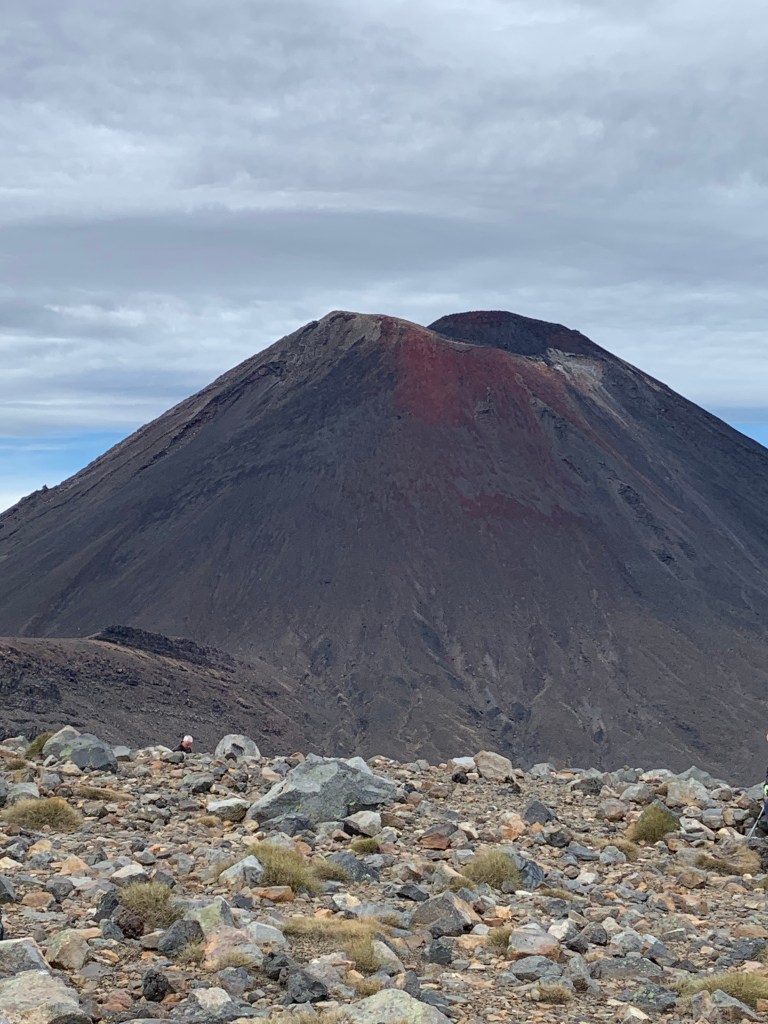
Photo below, starting out, looking up toward Mt Ngauruhoe, elevation 2,291m (7,516 ft). Mount Ngauruhoe – Wikipedia
It may look familiar to Lord of the Rings fans, Mount Doom.
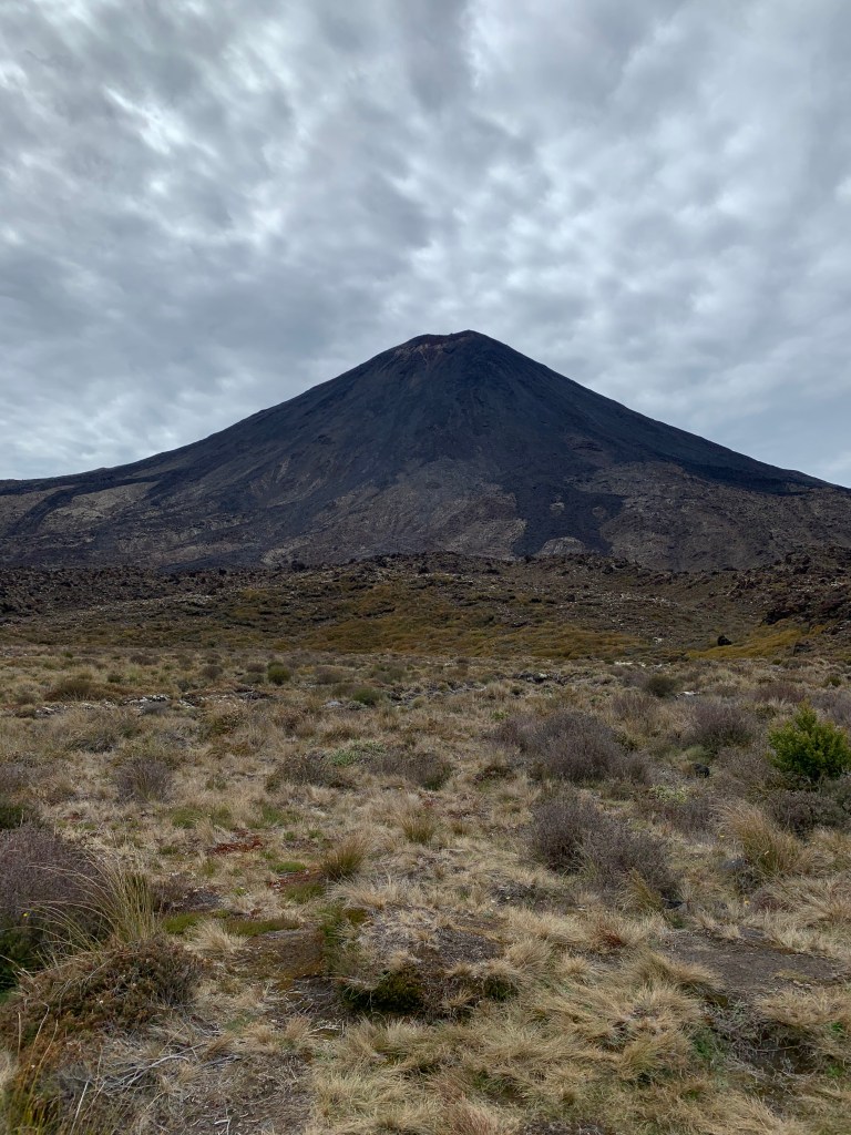
Photo below is looking back toward the start of the track at the Mangatepopo Carpark, which is at a 1,120m elevation.
The track climes the Mangatepopo valley to the saddle between Mount Tongariro and Mount Ngauruhoe.
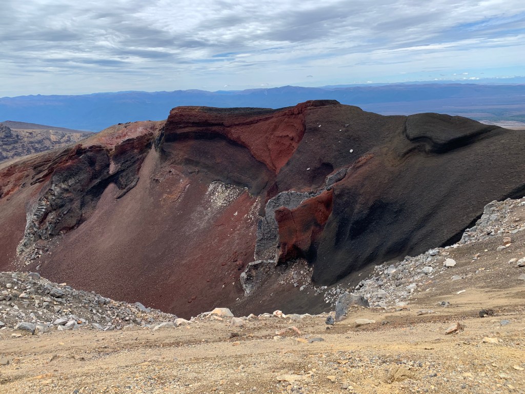
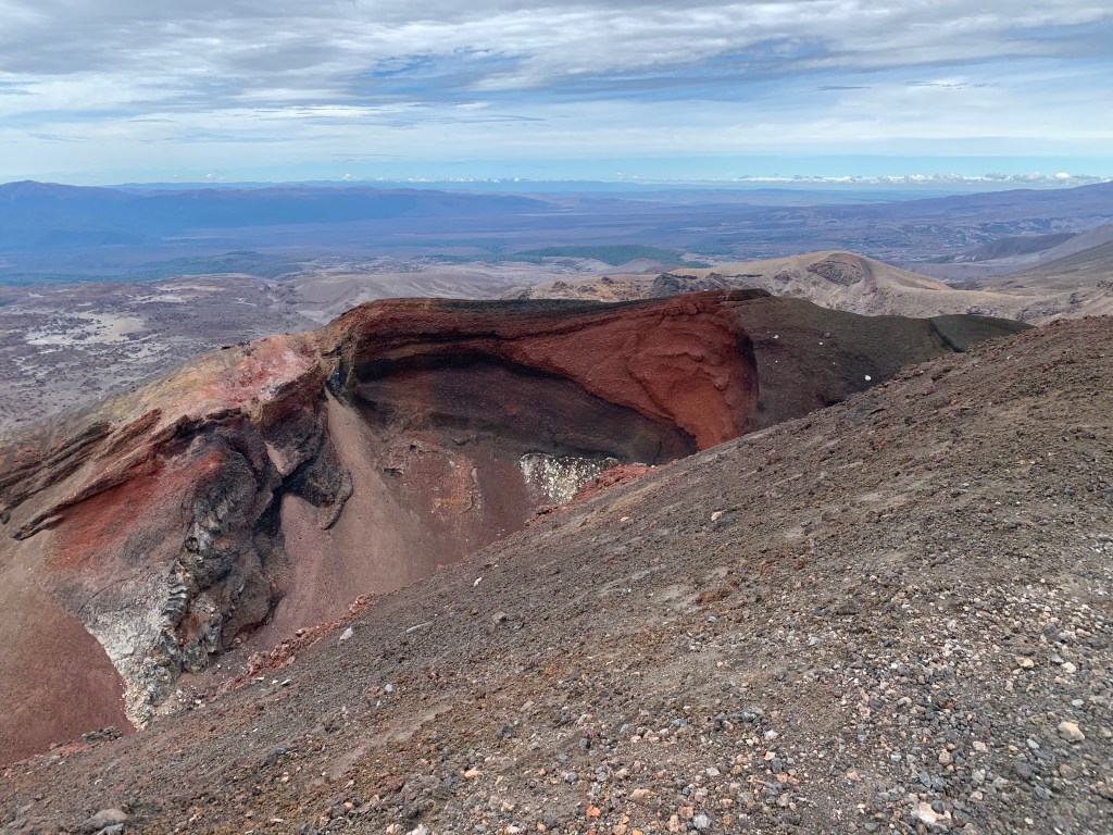
The highest point on the track is at the Red Crater, see below, at 1,886m. The trek finishes at the Ketetahi carpark, 750m elevation – overall you do more down hill than up hill!
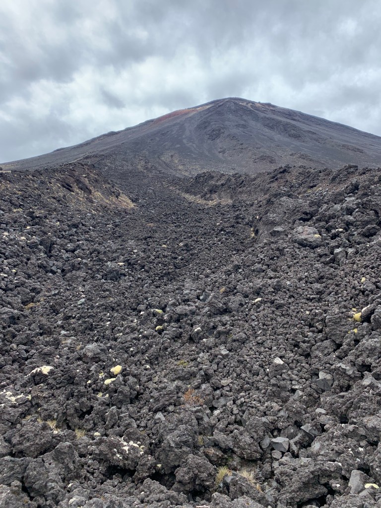
Below, views on the way up! Spectacular, an old lava field.
Views near the top, looking toward the South Island.
Can almost touch it and near the half way point, after crossing the south crater.
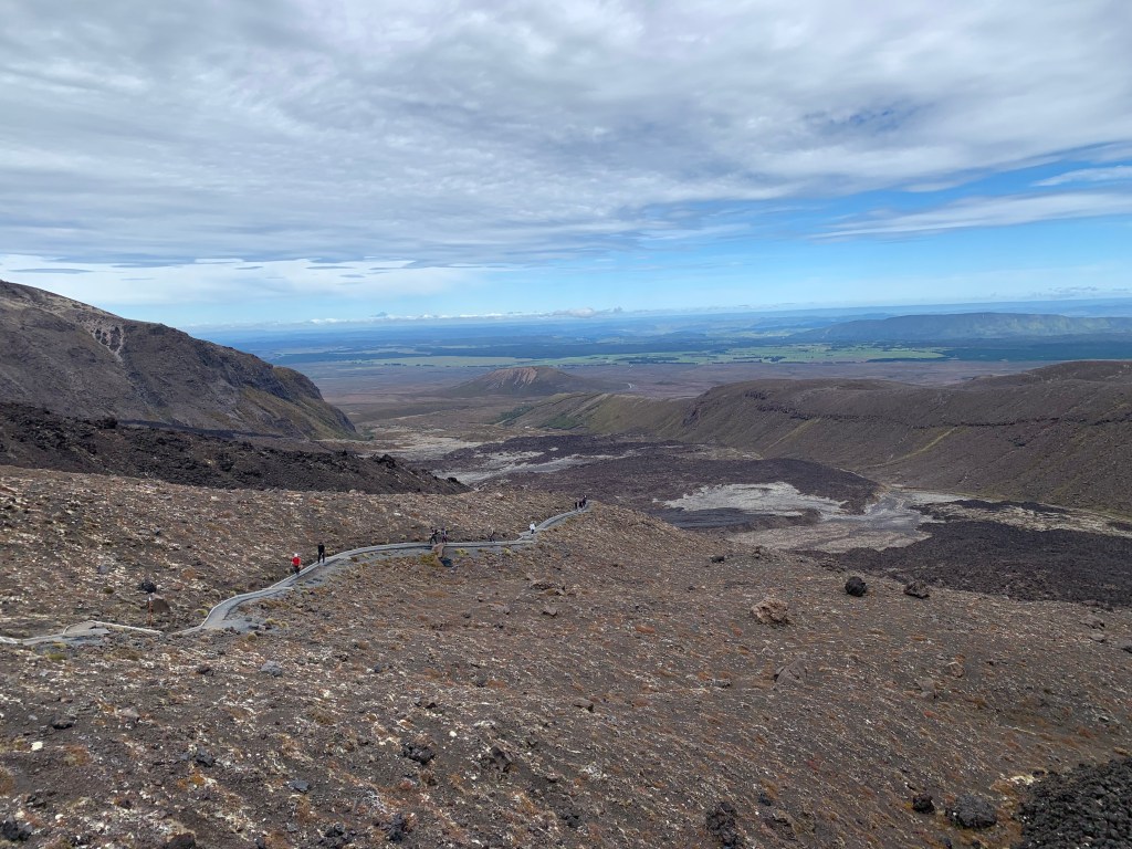
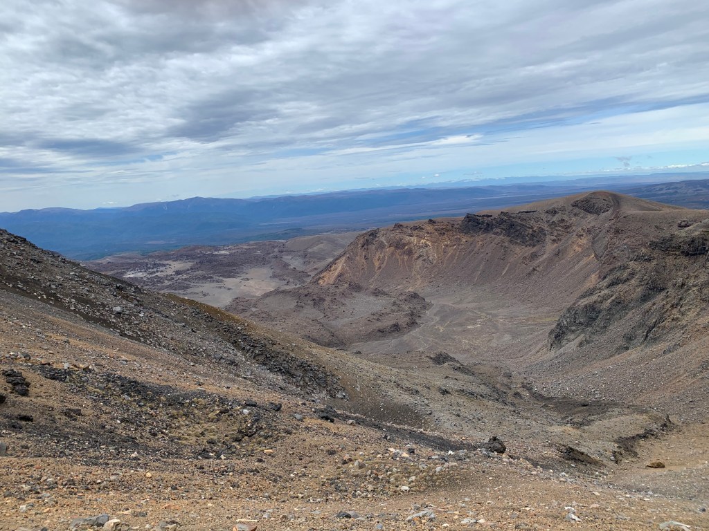
Landscape and views from near the top. Red Crater, big photo below.
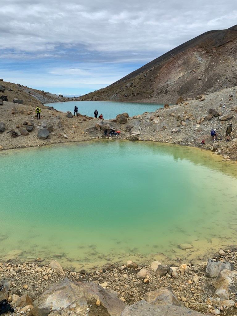
Views of the Blue lake (in the distance) and first sighting of the Emerald Lakes (smaller photo on right below).
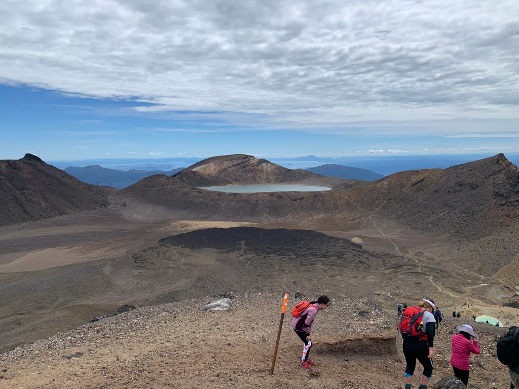
And the Emerald Lakes, strong smell of sulphur here.
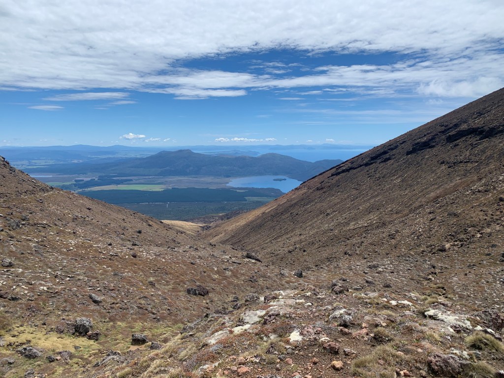
Heading down, after crossing the central crater and walking alongside the Blue Lake. In the photo below Lake Taupo is in the distance. Lake Rotoaira is the small lake in the foreground.
Background Tongariro Alpine Crossing
As mentioned above, the Crossing is 19.4km trek.
It is a point to point hike, there are several companies that provide shuttle services to make your day easier.
They will pick you up in National Park (small town nearby), dropping you off at Mangatepopo carpark, start of walk, collect you at the end of the days walk from the Ketetahi carpark, and return you to National Park. A very good service.
For further information on Tongariro Alpine Crossing, Tongariro Alpine Crossing Track | National Park | Walks & Hiking | Shuttle | World Heritage (tongarirocrossing.org.nz)
and
Tongariro Alpine Crossing Summer brochure (doc.govt.nz)
The Tongariro Alpine Crossing is situated in the Tongariro National Park.
Tongariro became a National Park in 1887 and boasts dual World Heritage status. It is New Zealand’s oldest National Park.
In 1990 the Park was recognised as a World Heritage Site for its outstanding natural values.
In 1993, Tongariro National Park became the first place in the world to be listed as a World Heritage Site for the spiritual and cultural values the landscape possesses for the indigenous people in the area.
The Park includes three active volcanoes Tongariro, Ngauruhoe and Ruapehu.
For more information: Tongariro National Park – Wikipedia
I hope you get to visit the Tongariro National Park, the surrounding towns, landmarks, attractions, and have time to complete the Tongariro Alpine Crossing. Please read up on the crossing and prepare accordingly. It is an alpine crossing and caution should be taken, a watchful eye on the weather is particularly important.
My 13 year old son and I completed the crossing in 4hrs, 40 minutes, including the odd stop and a lunch break. Teenage boys tend to be in a hurry!
Please read my Disclosure Statement
